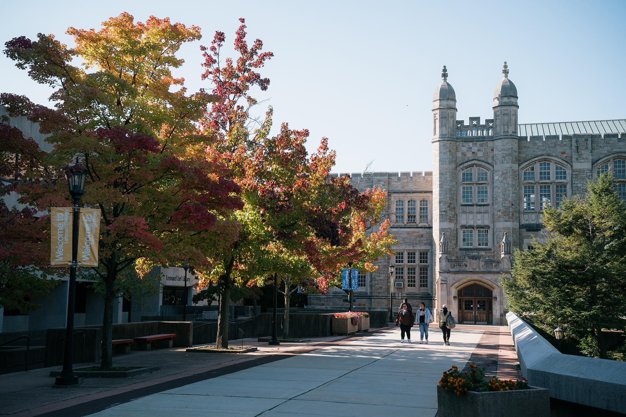
|


|
|
Bronx Neighborhood
Histories
Jerome Park Raceway, Harper's Weekly,
1886
Davies Collection, Courtesy of Lehman
College Library/CUNY Special Collections
Bedford Park neighborhood
Bathgate:
The name of this neighborhood remembers Alexander
Bathgate, even though a New York commission once tried to erase
his name from the map. Bathgate, a Scottish immigrant, worked
the land of the Morris estate in the early nineteenth century,
and was eventually able to buy 140 acres from Gouveneur Morris
II. His descendants sold the property to the city in 1884, for
use as a park which they expected would carry their name. But
after a surveying dispute, officials spitefully titled the new
green space Crotona Park.
Extension of the elevated line along Third Avenue at the turn
of the twentieth century brought to Bathgate a European immigrant
population largely drawn from lower Manhattan. (By the mid-twentieth-century,
it had been replaced by Latinos and African-Americans.) In 1982,
with many of its residential buildings derelict and abandoned,
the area welcomed a new development, the Federally-assisted 21-acre
Bathgate Industrial Park.
Baychester:
Between the colonial settlements of Westchester and
Eastchester, at the mouth of the Hutchinson River and the head
of Eastchester Bay, this flat and marshy section was devoted
to farming in the nineteenth century. Later plans for an airfield
and a brief life as an amusement park were succeeded by the building
of Co-op City (1968-70), one of the country's largest commercial
housing developments. Home to 60,000 people, many of them former
residents of the western Bronx, Co-op City has its own stores,
theatres, schools, and fire house. Alongside the 35 apartment
towers rise eight multilevel garages: Co-op City was made possible
by new highway constructionLong Island bridges, and the
Bruckner and Cross-Bronx Expressways, for examplejust as
earlier Bronx neighborhoods had been the result of subway building.

The Grand Boulevard and Concourse near Bedford
Park Boulevard, 1915
Bronx Chamber of Commerce Collection,
Courtesy of Lehman College
Library/CUNY Special Collections
Bedford Park:
In the 1880s, forty "villas," large suburban
houses, were built in the northeast Bronx on a 23-acre tract
named after a planned "garden" community in London.
Its only neighbor, the fashionable Jerome Park Racecourse just
to the west, was sold in 1894 to provide land for a new reservoir.
Bedford Park retained its rural exclusiveness until the 1920s,
when real estate developers, following the Grand Concourse and
new El and subway lines northward, started to build smaller residences
and apartment houses in the vicinity. Another boost to development:
unused land alongside the Jerome Park Reservoir provided sites
for some major Bronx institutionsthe Kingsbridge Armory
(1917), one of the world's largest, the campus of Lehman College
(begun in the early 'thirties as Hunter College in the Bronx),
and three high schoolsWalton, DeWitt Clinton, and the Bronx
High School of Science. (Recently the Reservoir itself, with
the surrounding green, has been designated a Bronx landmark.)
Belmont:
"Belmont" was the name of the nineteenth-century
estate of Jacob Lorillard, adjoining the factory and mill on
the Bronx River where he manufactured tobacco products. A small
village nearby kept the name after the factory was sold and the
estate broken up in the 1880's. (The Lorillard house itself became
a hospice, today St. Barnabas Hospital.) A decade later, construction
of the neighboring Bronx Zoo and the Jerome Park Reservoir drew
immigrant Italian artisans and laborers to Belmont, a population
reinforced when the Third Avenue El and IRT connected the neighborhood
with downtown Manhattan. The streets around Arthur Avenue, site
of the Enrico Fermi Cultural Center, are still lined with Italian
markets, bakeries, and restaurants.
Bronxdale:
Originally settled as a village on the Bronx River,
surrounded in the nineteenth-century by cloth factories which
used (and polluted) the river water, Bronxdale became residential
only after the construction of the subway in 1917. White Plains
Road, in the shadow of the elevated tracks, is the neighborhoods
main north-south artery. Contrasting Pelham Parkway (officially,
"Bronx and Pelham Parkway"), the main east-west thoroughfare,
is a broad tree-lined avenue along which cantering horses overtake
strollers and bike riders. Joining Bronx and Pelham Bay Parks,
it was laid out in 1884, part of an enlightened New York City
plan for a greenbelt in the soon-to-be annexed area.

Sentinel lions and pediment
Lion House, 1902-1903
NYS Wildlife Conservation Society/Bronx Zoo
Bronx Park
Bronx Park:
It occupies a piece of land along the Bronx River
approximately 2 miles long and 662 acres in area. Owned during
the eighteenth century by the Delancey family, it passed to the
Lorillards, manufacturers of tobacco products, who set up a snuff
mill that still stands. In 1884, the New York State Assembly
authorized the purchase of undeveloped land north of Manhattan
to be used as a park system for the increasingly crowded city.
Acquired in 1888, Lorillard land north of Fordham Road was allocated
to the New York Botanical Garden (1891), the land south of it
to the New York Zoological Society, which opened the "Bronx
Zoo" in 1899. In both areas, the collections were displayed
in remarkable buildings (such as the glass-and-steel Enid Haupt
Conservatory [1902] and the zoo's Baird Court). Also to be found
in Bronx Park: an impressively violent river gorge and the last
surviving forest in the city.
Bronx River:
The Indians called it Aquahung. Settlers named
it after Jonas Bronck, the earliest European farmer along the
East River shore of the mainland: it was "Broncks
River." Beginning in Westchester County, near Kensico Reservoir,
it winds fifteen miles southward to the base of Hunt's Point,
where it enters the East River. Along the way, it cuts through
Bronx Park in the dramatic gorge of the New York Botanical Garden,
and touches Williamsbridge, West Farms, Soundview, and other
Bronx communities. It is the major geographical divider of the
borough, the boundary between the hilly areas and the eastern
coastal plain, the border between the wards of "North New
York" on the Harlem side, annexed in 1874 and given an urban
infrastructure, and the much-later-developing sections of lower
Westchester. The importance of the river even seems to show up
in our boroughs name. Why do we add a definite articlethat
is, call it "the Borough of THE Bronx" rather than
"the Borough of Bronx"? (Compare "the Borough
of Brooklyn," for instance.) Some experts think its
because the name really denotes "the borough of the Bronx
River."
City Island:
City Island's name recalls an over-ambitious attempt
by Benjamin Palmer, who purchased the one-and-three-quarter-mile-long
island (called Minniford by natives) in 1761, hoping to divert
southbound trade to a new port on Long Island Sound. With the
collapse of these plans, City Island reverted to humbler maritime
occupations: the extraction of salt from seawater, the provision
of pilots for the dangerous waters of the East River, the building
of ships. Today a boating and fishing center, its main street,
City Island Avenue, is filled with restaurants.
Claremont:
The 38-acre holding of Martin Zborowski, a western
neighbor of the Bathgates, gave this neighborhood its name. The
city bought the estates of both families in the 1880s, creating
Claremont and Crotona Parks. The neighborhood, densely populated
in the twenties and thirties, was severed from Tremont
to the north by the Cross-Bronx Expressway, a damaging highway
project of the fifties. After Claremont housing and business
suffered almost total devastation in the sixties and seventies,
nearby Charlotte Street was visited by presidential candidates,
who publicized plans for urban rehabilitation. These were largely
realized in the following decades.
Clason's Point:
One of several peninsulas which protrude into the
East River from the southern Bronx, Clason Point stands between
the mouth of the Bronx River and, to the east, Pugsley's Creek.
The site of a large Native American settlement, comprising more
than seventy dwellings, it was known as Snapakins, "land
by the two waters," when the first European settler, Thomas
Cornell, established his farm in the mid-seventeenth century.
Dotted with summer estates in the nineteenth century (when it
borrowed the name of landowner Isaac Clason), the riverside settlement
soon attracted excursion steamers from downtown, offering swimming,
restaurants, dance halls, and other amusements. With the building
of the IRT tracks above Westchester Avenue in 1920, the neighborhood
became home to commuting families. In the 1980's, the last of
the large beach clubs was replaced by a public housing project.
Crotona Park
East:
In 1884, after wrangling with the Bathgate family
over details of the land purchase, city commissioners refused
to honor an agreement to name a new park after its former owners.
Instead, they called it "Crotona"although no
one is any longer sure why they chose that title. Were they commemorating
an ancient city of Italy, famed for its athletes and philosophers?
Or were they thinking of the New Croton Aqueduct, under construction
not far away? Once countryside bordering the town of West Farms,
the area around the park had been annexed by New York City in
1874. Crotona, crowded with tenement and apartment houses through
the first half of the 20th century, attracted national attention
in the seventies with its burned-out buildings and bulldozed
vacant lots. Today the neighborhoods single-family housing
developments, such as Charlotte Gardens, bring a suburban character
to the central Bronx.
Fordham:
Fordham ("village by the ford") refers to
a settlement near a shallow crossing of the Harlem River, until
1693 the only entry to Manhattan from the north. The large manor
which took the name originally stretched from the Harlem to the
Bronx River, and south from what is today Kingsbridge Road to
Highbridge. Divided into farms after the failure of the original
sixteenth-century grantholder, John Archer, Fordham's rural anonymity
went undisturbed until the New York and Harlem Railroad, pushing
north, opened a station at what is now Fordham Road and Webster
Avenue in 1841. Two responses to this new accessibility are recalled
by sites in the neighborhood. In 1845 Edgar Allan Poe brought
his ailing wife from Manhattan to rural Fordham. On Grand Concourse,
across the street from its original location, stands the cottage
where the Poes lived, and where he wrote "Annabell Lee"
and "The Bells". Even closer to the railroad line is
the campus of Fordham University, which was opened by Bishop
John Hughes as St.John's College in 1841. Like most of the northern
Bronx, the Fordham area remained dormant until cheap public transportation
supplemented the rail line. In rapid succession, the Third Avenue
El (1903), the Jerome Avenue IRT (1914), and the IND under Grand
Concourse (1933) opened the neighborhood to emigrees from Manhattan
and the lower Bronx. By the 'thirties Fordham Road, the main
east-west thoroughfare, had replaced 149th Street as the borough's
major shopping and entertainment center.
|

Concourse Plaza Hotel, Grand Concourse, ca.
1930
Bronx Chamber of Commerce Collection,
Courtesy of Lehman College
Library/CUNY Special Collections
|
|

Yankee Stadium, ca.1940s
Bronx Chamber of Commerce Collection,
Courtesy of Lehman College
Library/CUNY Special Collections
|
Grand Concourse:
Starting at 138th Street and running north to Mosholu
Parkway, the Grand Boulevard and Concourse (as it is properly
named) is the Bronx's grandest street, four and one half miles
long. Designed in 1892 by farsighted engineer Louis Risse to
give access to parkland to be built north of the city, it was
finally constructed in the first decade of the twentieth century.
The eleven lanes run between tree-shaded islands, originally
meant to separate bicycle, horse and pedestrian traffic. Cross-traffic
at major intersections passes below or above the boulevard (an
innovation borrowed by Risse from Olmstead and Vauxs Central
Park). The Concourse is lined with apartment buildings, many
of them brilliant examples of the 1930s Art Deco and Art Moderne
styles. The newly-restored Heinreich Heine fountain at 161st
Street marks the original entrance to the Concourse, which was
extended southward in 1927.
|

The speedway and Highbridge with the aqueduct
in background, ca. 1910
Bronx Postcard Collection, courtesy of
Lehman College Library/CUNY Special Collections
|
Highbridge:
This neighborhood takes its name from a monumental
crossing of the Harlem River at 173rd Street, the oldest New
York City bridge still standing. In 1838, planners debated how
the aqueduct bringing water from the Croton Reservoir would cross
the Harlem to Manhattan. The alternatives: a pipe set on an embankment
just above water level, and one on Roman arches of stone 180
feet above the water's surface. The more difficult but more splendid
"high bridge" having been chosen, it took until 1848
for laborers, many of them Irish immigrants housed at the site,
to complete what was at the time the longest and highest stone
arch bridge in the United States.
The laborers' settlement, "Highbridgeville," was
succeeded later in the century by a resort supplied with visitors
by steamboats from downtown New York. It was not until after
1918, when north-reaching subway lines arrived in the area, that
dense residential development began. In the 50's housing projects
were introduced, while the Cross-Bronx Expressway, bridging the
Harlem just north of Highbridge, cut a new boundary line for
the neighborhood.

Farmer's Square Restaurant Bar and Grill at
the Bronx Terminal Market, south of Highbridge, as it appeared
in the 1930's
Bronx Chamber of Commerce Collection,
Courtesy of Lehman College
Library/CUNY Special Collections
Hunts Point:
The native inhabitants of this peninsula jutting into
the East River called it Quinnahung, "the long high
place." As at neighboring Clason Point, there was a large
Indian settlement and burial ground here. Sale by the Native
Americans in 1663 was followed by sparse development: only in
the nineteenth century were the Legget and Hunt farms replaced
by estates such as that of Col. Richard Hoe, inventor of the
rotary press. The sections north of Hunts Point filled with apartment
houses in the nineteen- twenties, as the new IRT lines made it
possible for renters to move to the "East Bronx," bypassing
the crowded neighborhoods of Mott Haven and Morrisania. Today,
the industries of Hunts Point have been joined by New York's
produce and meat markets, displaced from their old Manhattan
locations.

King's Bridge Road near Dyckman's Farm, ca.
1870
Bronx Postcard Collection, courtesy of
Lehman College Library/CUNY
Special Collections
Kingsbridge:
The first bridge to Manhattan, over which for nearly
a century all land traffic was obliged to pass, stood near what
is today the corner of Kingsbridge Avenue and 230th Street, then
the bank of Spuyten Duyvel Creek. The short wooden structure
was built in 1693 by Frederick Phillipse, lord of Phillipse Manor,
whose royal patent justified the name "King's Bridge"
and the imposition of highly-resented tolls. A colonial attempt
to break the stranglehold, the building of a Farmer's Free Bridge
[1759] just to the southeast, showed Phillipseburgh interests
which way things were headed. After the Revolution, the Tory
manor was seized and divested of its rights.
In the eighteenth century a village had grown up at the bridgehead,
feeding and supplying cattle drovers and carters who stopped
at the tollgate. Kingsbridge in the nineteenth century came under
the control of Yonkers, and later annexed itself to New York
City. Serving the nearby Johnson Iron Foundry and offering a
depot on the New York Central railroad, the town, centered on
230th street (called Riverdale Avenue), prospered in its rural
setting until the Broadway line of the IRT subway was completed
in 1907, and urbanization of the area began. By 1923, a canal
had been cut almost a mile to the south, and the old creek filled
in, leaving the site of the Kings Bridge high and dry.
Longwood/Foxhurst:
Samuel B. White's estate, Longwood Park, stood north
of Hunts Point: his former residence is today by the Police Athletic
League center on 156th Street. In the late nineteenth century,
Longwood and neighboring holdings were subdivided into residential
lots. The Longwood Historic District preserves some of the row
houses built between 1897 and 1901.

Morrisania Village, ca. 1880
Bronx Chamber of Commerce Collection,
courtesy of Lehman College
Library/CUNY Special Collections
Morrisania/East
Morrisania:
In 1783 Lewis Morris, legislator and signer of the
Declaration of Independence, proposed that the new republic build
its capital on his estate, Morrisania, in what is now the southwest
Bronx. With more than 2,000 acres on the mainland, and deepwater
access, the Morris manor was not an unlikely seat for a new city.
Although the offer was tabled, Morrisania retained its local
prominence by linking itself, earlier than most of its neighbors,
with New York City to the south. The New York and Harlem Railroad
was extended from Manhattan to Morrisania in 1842, bringing first
laborers and then more substantial residents to the village,
incorporated in 1848. German immigrants predominated, establishing
piano factories, breweries, turnveriene (athletic clubs) and
choral societies. Annexed to New York in 1874, Morrisania filled
with tenements after the Third Avenue Elevated Railroad, entering
the Bronx in 1888, made it cheap and easy for workers to commute
to jobs downtown. In 1904, the first year of its operation, the
New York subway crossed southern Morrisania (called Melrose)
along 149th Street, intersecting the El at the congested "Hub,"
which rapidly became the entertainment and shopping center of
the borough. By 1920, the section had reached the peak of its
population (in which Eastern Europeans had joined Italians, Irish,
and Germans) and prestige, although residents were already leaving,
following the new subway lines north and east. A later Manhattan
legacy were Puerto Rican and African-Americans, often forced
from their homes by urban renewal projects, who came to Morrisania
in the 1950s. Morrisania has two main east-west streets. Along
149th street are sited Lincoln Hospital (1976), Hostos College
(1968), the main Post Office (1937) and the still-thriving shopping
center at the Hub, where Third Avenue meets Westchester Avenue.
161st Street, anchored at the west by Yankee Stadium (1923),
leads past the Bronx County Building (1934). (An earlier court
building ((1906)) still stands at the intersection of 161st and
Third Avenue.) The Grand Concourse, which originally began at
161st Street and headed north, was extended southward to 137th
Street in 1927, forming, with Jerome Avenue and Third Avenue,
Morrisania's north-south axes.
Mosholu/Norwood:
Mosholu, "smooth stones," is a tribal name
for Tibbett's Brook, a southward-running stream in the west of
the borough. In 1884, when New York laid out parkland in the
newly-annexed districts, the broad avenue joining Van Cortlandt
and Bronx Parks was named Mosholu Parkway. Between it and Woodlawn
Cemetery to the north, on land originally belonging to the Varian
farm, grew up a neighborhood particularly well-served by transportation,
home to the Williamsbridge Reservoir (1888), now a playground,
and Montefiore Hospital (1912). The upper portions of the area,
near busy Gun Hill Road, are known as Norwood.

Mott Haven, 138th Street and 3rd Avenue, ca.
1920
Bronx Chamber of Commerce Collection,
Courtesy of Lehman College
Library/CUNY Special Collections
Mott Haven:
In 1828, Jordan L. Mott, inventor of a coal-burning
stove, established a factory near what is now Third Avenue and
E. 134th Street. (The Mott foundry, in operation into the twentieth
century, became one of many notable ironworks in the Bronx, along
with the nearby Janes, Kirtland and Company, which cast and built
the iron dome of the Capitol in Washington [1863].) In 1850 the
owner of the works, a vigorous promoter of his land and himself,
established a village unembarrassedly named Mott Haven. One rival
joked that the Harlem would shortly be rechristened the Jordan
River. But commuters were attracted from Manhattan, and soon
the name was being applied to the southwest corner of the borough,
below 149th Street between the Harlem and East Rivers. Here,
from the late nineteenth-century into the nineteen-forties, residential
streets with elegant row houses, some now preserved in the Mott
Haven Historic District, flourished in the midst of an industrial
area (notable for its many piano factories).
Mount Eden:
One of the west-central Bronx neighborhoods (Claremont,
Mount Hope, Fairmount) which take their names from hilltop estates,
this one the property of Rachel Eden, who purchased it in 1820.
Mount Eden was rural until the 1920s, when apartment houses began
to line the streets. Bronx-Lebanon Hospital (original building,
1942) marks the intersection of Mount Eden Avenue and the Grand
Concourse.
Parkchester:
When the area east of the Bronx River was joined to
New York in 1894, Louis Risse, the imaginative engineer who designed
the Grand Concourse, had big plans for its development. But his
street design, with avenues meeting in monumental traffic circles,
was opposed by large landholders, who succeeded in having all
but one of the circles expunged from the final 1903 plan. That
one survivor, Hugh J. Grant Circle on Westchester Avenue, became
the focus of an major East Bronx neighborhood in 1938, when the
Metropolitan Insurance Company chose a 129-acre tract just to
the northeast for its city-within-the-city of 40,000 residents,
Parkchester. The great housing development, with its parks and
walkways, still survives, its apartments largely converted to
co-ops, its original "whites only" rental policy (challenged
and changed in the 1960s) happily forgotten by the multi-ethnic
residents.
|

The monorail in Pelham Bay Park, 1910-1914
Bronx Postcard Collection, courtesy of
Lehman College Library/CUNY Special Collections
|
|

The horse car in Pelham Bay Park, ca. 1900
Bronx Postcard Collection, courtesy of
Lehman College Library/CUNY Special Collections
|
Pelham Bay Park/Pelham
Parkway:
These 2,764 waterfront acres in the northeast Bronx
hold a long sand beach (Orchard Beach, 1936)), bridle and bicycle
paths, two golf courses, a rowing lagoon, a firing range, an
athletic field (Rice Stadium, 1922), a wildlife refuge, and an
historical home of the Pell family, whose manor, Pelham, gives
the area its name. The park, second-largest in New York City,
is the site of an important battle of the American Revolution,
and of the 1643 death of Anne Hutchinson and her followers in
an Indian raid. The last expansion of the IRT subway reached
Pelham Bay Park after World War I; but from 1910 to 1913 there
had been a connection to the New Haven railroad line via monorail.
Port Morris:
A peninsula in the western Bronx, south of the Bruckner
Expressway, this waterfront industrial area once had hopes of
competing with New York City as a seaport. The ambitious nineteenth-century
plans of Gouveneur Morris II came to nothing, but today's Port
Morris, its streets and their furniture renewed, is again seeking
to attract development as "the Gateway to the Bronx."
Riker's Island:
The island is part of the Bronx, although its
reached by a bridge from Queens. Bought by New York City in 1884
from the Ryker family, which had farmed it from the seventeenth
century, the island in 1932 became home to a prison meant to
replace one on Blackwell's (now Roosevelt) Island in the East
River. Gradually enlarged to over four times its original size,
Riker's Island today houses fifteen thousand prisoners in eleven
jails (and a hospital). It is still, in small part, farmland:
with the assistance of the New York Horticultural Society, inmates
have been growing vegetables since the '80s.
Riverdale:
|

The Knolls/Riverdale, 1951
Bronx Chamber of Commerce Collection,
courtesy of Lehman College Library/CUNY Special Collections
|
|

The Isaak and Johnson Iron Works/Riverdale
Tieck Collection, courtesy of Lehman College
Library/CUNY Special Collections
|
From 1851 the New York and Hudson Railroad, running
along the east shore of the river, offered a connection between
Manhattan and a stop at Riverdale-on-Hudson, today's 254th Street.
The ridge above the station filled with the estates of wealthy
commuters. Greyston (1864), Alderbrook (1880), Stonehurst
(1861), and Oaklawn (1863) are mansions which survive;
there's also a Riverdale Historic District, calling attention
to houses which were once the outbuildings and carriage houses
of the grand estates. A bridge and parkway connection to Manhattan
brought new houses, smaller but not less opulent, in the decade
before World War Two. Today, many of the original estates have
been sold or donated to institutionsthe Wave Hill Center
for Environmental Studies, Riverdale Country School, the Greyston
Conference Center among them.
Soundview/Bruckner:
This section, once the site of an Indian settlement,
lies along the east side of the Bronx River (and far from any
view of the "Sound"). Its residential life developed
in two stages. In the 20s, the Westchester Avenue IRT brought
tenement refugees to the "East Bronx" and its modest
houses. In the 60s, the Bruckner Expressway, a heavily-traveled
east-west link, was soon bordered by the towers of housing projects.
(Soundview Park, a ninety-three acre tract owned by the city,
has thus far been used only for temporary housing, as our picture
shows.)
Spuyten Duyvil:
A steep ridge south of Riverdale, overlooking the
entry of the Harlem River into the Hudson, the Indians called
it "Shorrack-kappock," which is why there is a Kappock
Street in the area today. It was named Tippett's and Berrian's
Neck, after early settlers who had homes on the hillside. But
Spuyten Duyvil is the name the Dutch used, variously explained.
Washington Irving attributes it to Peter Stuyvesant's trumpeter,
who swore to row across the rough stretch where the waters met
"in spite of the devil." What was once Spuyten Duyvil
Creek, meandering east, south around the Johnson Iron Works,
and then north past Marble Hill, has been straightened and widened
into today's Harlem River Ship Canal. Originally to be crossed
only upstream at Kingsbridge, it is bridged today by the steel
arch of the Henry Hudson Bridge (1936), carrying a parkway, which
touches the Bronx not far from the column in Hudson memorial
Park. The hill at Spuyten Duyvil is covered with tall apartment
houses built in the 50s and 60s.
Throgs Neck:
Named for John Throckmorton, who settled in the area
under the Dutch in 1643, the Neck is a peninsula at the extreme
southeast of the Bronx, at the base of which a suspension bridge
springs off toward Long Island. That span, the Throgs Neck Bridgedesigned,
like its western neighbor the Bronx-Whitestone Bridge, by Othmar
H. Ammannopened in 1961. In the shadow of its north tower
is Fort Schuyler, a 19th-century fortification paired with Fort
Totten, in Queens, to guard the entrance to the East River. (Today
Schuyler houses the New York State Maritime College, a part of
the state university.) A beach resort at the turn of the twentieth
century, the neighborhood of Throgs Neck today is covered with
residences ranging from exclusive beachfront enclaves to a low-income
housing project.
|

Burnside Avenue and University Avenue, Old Aqueduct,
ca. 1930's
Bronx Chamber of Commerce Collection, Courtesy
of Lehman College
Library/CUNY Special Collections
|
|

The Home for the Incurables, West Farms, 1870 (then
considered Westchester
County, NY)
Davies Collection, Courtesy of Lehman College
Library/CUNY Special Collections
|
Tremont:
A postmaster invented the name for this west central
Bronx neighborhood in the mid-nineteenth century, alluding to
three estates (Fairmount, Mount Eden, and Mount Hope) that were
located here. Served by an east-west streetcar running between
the north-south elevated and railroad lines, Tremont developed
earlier than many neighboring sections. Its stature was confirmed
when the municipal building of what was about to become the Borough
of the Bronx opened, in 1897, at East Tremont and Park Avenues.
Tremont's decline was equally rapid. In the 1950s, the Cross
Bronx Expressway cut across the neighborhood just south of East
Tremont Avenue, detaching it from Claremont and Crotona. In the
70s an imaginative set of "scatter-site" residences,
called the "Twin Parks" project, helped to stitch Tremont
together again.

Bruckner and Boynton Avenue East/Quonset Huts,
1946
Bronx Chamber of Commerce Collection,
courtesy of Lehman College
Library/CUNY Special Collections
Unionport:
Despite its name, which reminds us of the river traffic
which once plied Westchester Creek, the Village of Unionport,
established in 1851, was devoted mainly to farming before its
annexation by New York City in 1895. Today, the residential neighborhood
is nearly in the shadow of the tangled highway overpasses at
the heavily-used Bruckner Interchange, where two interstate highways
meet the approach to the Bronx-Whitestone Bridge.
|

The Hall of Fame for Great Americans as it appeared
ca. 1950's
Bronx Chamber of Commerce Collection, Courtesy
of Lehman College
Library/CUNY Special Collections
|

The Hall of Fame for Great Americans
New York University, Bureau of Public Information,Courtesy
of Lehman College Library/CUNY Special Collections
|
University Heights:
In 1891 Henry Mitchell MacCracken, the Chancellor
of New York University, proposed the removal of its undergraduate
college from crowded Washington Square to the rural Bronx. Construction
of neo-Renaissance buildings by architect Stanford White began
in 1894 on the site of the Mali estate, on a portion of the Fordham
ridge above the Harlem River which was re-christened University
Heights. The NYU campus expanded in the twentieth century, as
architectural styles changed from the classicism of the Hall
of Fame (1901) to the brutal concrete of buildings by Marcel
Breuer in the 1960s. Meanwhile, the area along University Avenue
became heavily residential, with elegant apartment houses rising
north and south of Fordham Road. After a turbulent period in
the 70s and 80s, when residents left for the suburbs and housing
was abandoned, a recovered University Heights is today anchored
by Bronx Community College, occupying the campus sold by NYU
in 1973.
Westchester
Heights (Westchester Square):
The Dutch in New Amsterdam regarded this as an outpost
on their northeastern border, and named it Ostdoorp (East Town).
But to the English from western Connecticut who settled the village,
and took possession in 1664, it was West Chester. Set amid farms
on a broad creek leading to the East River, it became a significant
port and (until 1756) the governmental center of the area which
included todays Bronx and Westchester Counties. The old
village center (where St. Peter's Church, organized in 1693,
can still be found) is now the busy intersection of East Tremont
and Westchester Avenues. The neighborhood, with Westchester Heights
to the north, is home to many medical facilities, including Einstein,
Jacobi, Calvary, and Bronx State Hospitals.
Williamsbridge:
Farmer John Williams colonial tollbridge on
the Bronx River gave this neighborhood its name. Farms dominated
the landscape for two centuries. Williamsbridge farmers were
raided for supplies by British and Colonial irregulars during
the Revolutionary War. Fifty years later, they were sending their
produce to Manhattan via the new Harlem railroad line. (Metro
North has kept its Williamsbridge stop.) Some farms were still
here in the 1920s, when the White Plains Road IRT subway began
to bring commuters looking for apartments and small houses. Today
Gun Hill Road cuts across a heavily residential area, home to
much of the Bronxs Carribean population.

Early subway passenger, ca. 1935 (Broadway
IRT)
The Kay Post Collection, Bronx Institute
Archives, Courtesy of Lehman
College Library/CUNY Special Collections
Woodlawn:
The nineteenth-century taste for landscaped, park-like
burial grounds was gratified by the opening of Woodlawn Cemetery
in 1865. Unlike its predecessor, Brooklyn's Green-Wood, rural
Woodlawn could be easily reached from Manhattan on the Harlem
railroad, which had entered the area in the 1840s. The burial
of Admiral David Farragut in 1870 established the reputation
of Woodlawn with the New York elite, many of whom commissioned
prominent architects to design their mausoleums on the Bronx
River hillside. The neighborhood grew with the cemetery. In 1873
forty to fifty houses in the area just to the north, once part
of Philipse manor, later the farm of Gilbert Valentine, were
incorporated as the village of Woodlawn. The Irish and Italian
character of the area was determined in the 1890s, when the construction
of the second Croton Aqueduct brought a new population of workers
to the village.
Credits
Cook, Harry T., The Borough of the Bronx, 1639-1913
(New York: by author, 1913); Articles by Edward Bergman, Peter
Derrick, Evelyn Gonzalez, Gary Hermalyn, Kenneth Jackson, Jonathan
Kuhn, John McNamara, Lloyd Ultan, Joseph Viteritti, Gerard Wolfe,in
Jackson, Kenneth T. (ed.), The Encyclopedia of New York City
(New Haven: Yale University Press, 1995); Jonnes, Jill, We're
Still Here: the rise, fall, and resurrection of the South Bronx
(Boston: Atlantic Monthly, 1986); McNamara, John, History
in Asphalt: the origin of Bronx street and place names (Harrison,
NY: Bronx County Historical Society/Harbor Hill Books, 1978);
McNamara, John, McNamara's Old Bronx (Bronx: Bronx County
Historical Society, 1989);Mead, Edna, Bronx Triangle: A portrait
of Norwood (Bronx, NY: Bronx County Historical Society, 1982);
Ross, Davis, The Bronx: An Interpretive Chronology (privately
printed: rev.1988); Tieck, William, Riverdale, Kingsbridge,
Spuyten Duyvil, New York City (Old Tappan, NY: Revell, 1968);
Toscano, Jeanine, History of Williamsbridge (Bronx, NY:
Williamsbridge Federation, 198?);Ultan, Lloyd and Gary Hermalyn,
The Bronx in the Innocent Years (1890-1925) (New York:
Harper and Row, 1985); Ultan, Lloyd, The Beautiful Bronx (1920-1950)
(New Rochelle, NY: Arlington House, 1979); Willensky, Elliot,
and Norval White, AIA Guide to New York City, 3rd ed.
(New York: Harcourt, 1988); Welcome to Woodlawn Heights
(Bronx, NY: Woodlawn Heights Taxpayer and Community Association,
1970).
|